The most common misstep we see on sites across Bedford is assuming a gentle slope on Oxford Clay won't develop a deep-seated failure plane after a wet winter. The Great Ouse valley and its tributary corridors have shaped a landscape where relic shear surfaces and seasonal groundwater spikes can destabilise embankments that stood for a decade. A slope stability analysis run solely on desktop geology without factoring in the town's perched water tables—particularly near Brickhill or the Castle Road cuttings—gives a false sense of security. Our team checks pore pressure regimes against BS EN 1997-1:2004 Design Approach 1, running both drained and undrained scenarios to catch the condition that actually governs the factor of safety. When ground investigation logs reveal softened clay seams, we often recommend pairing the analysis with triaxial testing to measure effective shear strength parameters directly rather than relying on conservative correlations from index testing.
A slope that survives ten dry summers can fail in the eleventh wet winter if the analysis ignores Bedford's perched groundwater regime.
Methodology applied in Bedford
Risks and considerations in Bedford
Bedford's expansion from a Saxon river crossing into a modern commuter belt has pushed residential development onto valley sides and former brickpit sites where the ground carries a century of industrial reshaping. The steep embankments along the Midland Main Line and the cuttings carved for the Bedford Western Bypass are tangible reminders that cut slopes in overconsolidated clays relax over time, opening fissures that let water in and shear strength out. A stability failure here rarely announces itself with dramatic collapse; it begins as a slow creep that cracks retaining walls and distorts road pavements. Developers who skip a formal slope stability analysis risk Section 38 adoption delays or, worse, a slope remediation bill that dwarfs the original earthworks cost. Our reports quantify the probability of a serviceability limit state exceedance under the design groundwater scenario, giving the design team a defensible basis for reinforcement or drainage measures.
Our services
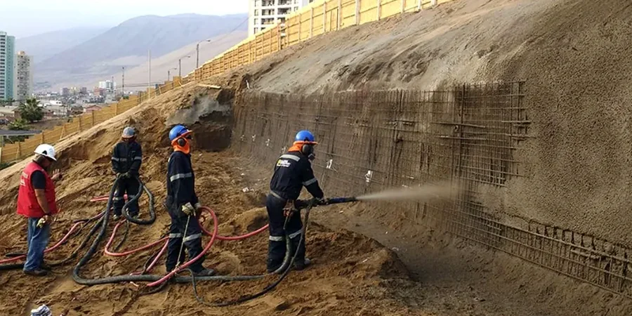
We deliver slope stability packages tailored to the geological conditions encountered across Bedford Borough, from the river terrace gravels near the Embankment to the steep cuttings in the Woburn Sands formation. Every analysis is supported by a ground investigation programme designed to capture the stratigraphic controls that govern failure mechanisms in this part of the Ouse catchment.
Limit Equilibrium Stability Modelling
We build two-dimensional models in Slide2 or SLOPE/W using site-specific stratigraphy and laboratory-measured shear strength parameters. Each model runs multiple search algorithms to locate the critical slip surface under short-term, long-term, and seismic loading conditions. Outputs include factor of safety contours, reinforcement requirements for soil nails or ground anchors, and sensitivity analyses showing the influence of groundwater level on overall stability.
Construction-Phase Monitoring and Review
Stability is not a one-off calculation. We install inclinometers and piezometers in high-risk cut slopes and monitor deformation rates during and after earthworks. If movement trends approach trigger levels defined in the design report, we review the ground model against actual exposed conditions and recommend contingency measures—whether additional drainage, toe berms, or revised batter angles—to keep the works on programme without compromising safety.
Quick answers
What is the typical cost of a slope stability analysis for a single-family residential plot in Bedford?
For a residential plot requiring a cut or fill slope assessment, the analysis typically falls between £950 and £3,790, depending on the height of the slope, the complexity of the ground profile, and whether existing borehole data can be used or new investigation is needed. A simple infinite-slope check on a shallow embankment sits at the lower end; a deep-seated failure analysis with transient seepage modelling for a slope over 5 metres falls at the upper end.
How does the Oxford Clay affect slope stability in the Bedford area?
Oxford Clay is a heavily overconsolidated stiff clay that contains thin silt partings and occasional limestone bands. When cut, it undergoes stress relief that opens fissures over time, increasing mass permeability and allowing water to penetrate deeper into the slope. The effective cohesion intercept (c') can drop significantly as the clay weathers, so we always run both peak and residual strength scenarios to capture long-term degradation in our analysis.
When does Bedford Borough Council require a slope stability report for planning?
A formal slope stability report is typically required under planning conditions when a development proposes cuts or fills exceeding 2 metres in height, or when the site lies within a designated slope instability hazard zone. The report must demonstrate compliance with BS EN 1997-1:2004, addressing both ultimate and serviceability limit states, and is reviewed by the Council's geotechnical consultant before discharge of the condition.